28 November 2025
Autonomous, scalable, real-time climate monitoring
We speak to Mathieu Johnsson and his team at Bristol-based startup, Marble, who are leading the Arctic DronePort project – part of our Forecasting Tipping Points programme.
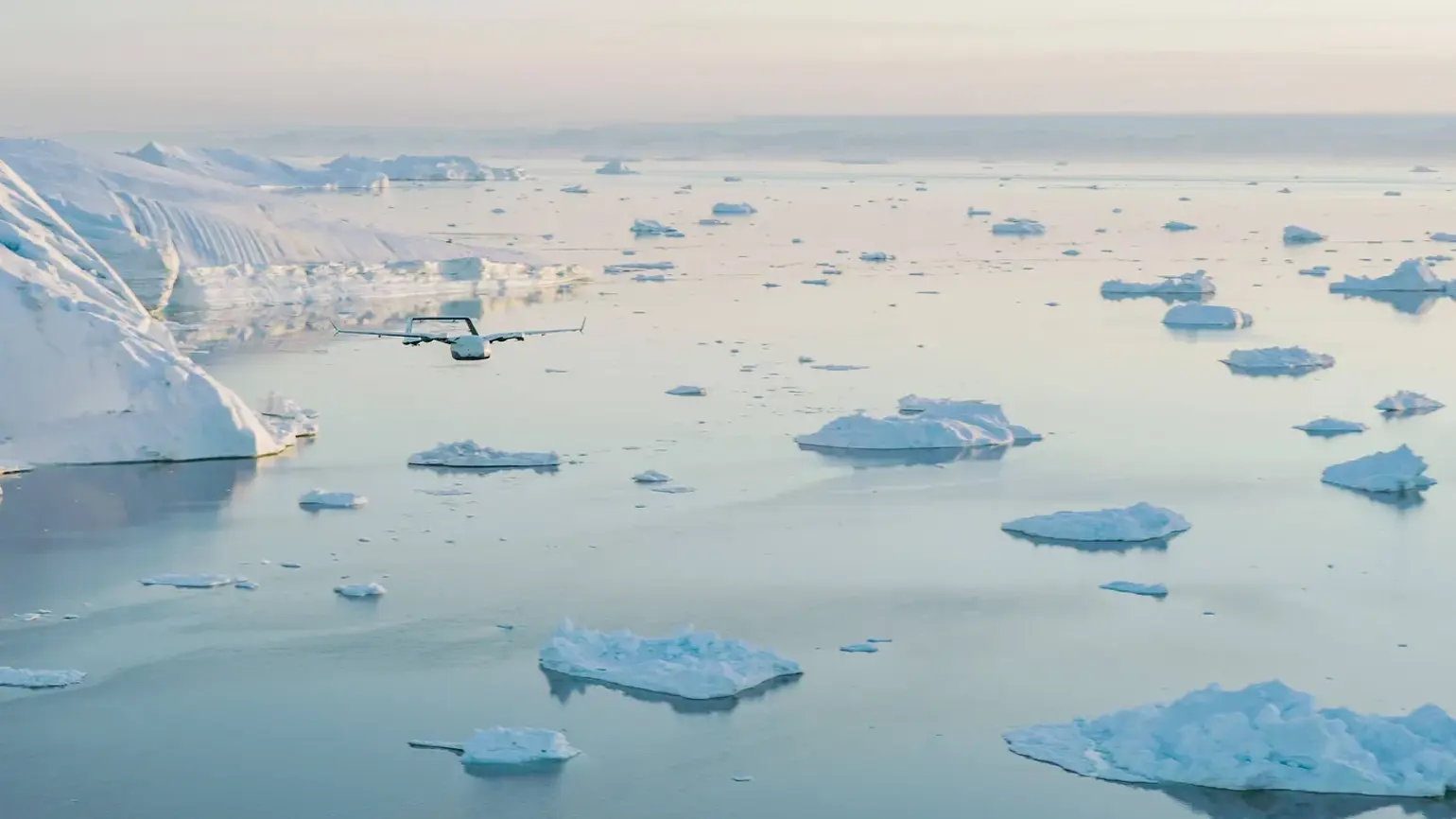
Marble conducting test flights over Ilulissat Icefjord, Greenland, May 2025. These initial tests validated Marble’s cold weather drone systems under real-world conditions. Credit: Marble, Arctic DronePort project.
The team is looking to enable real-world environmental monitoring through a distributed network of unmanned hangars and fast, low-cost drones. As a first step, they’re monitoring the icefjord of Ilulissat – a coastal town in western Greenland – to better understand the accelerating retreat of the Sermeq Kujalleq Glacier and the sudden rolling of icebergs in Disko Bay.
We caught up with Mathieu at Greenland Science Week to hear how they’re innovating Arctic remote sensing and using their data for near-term climate forecasts.
Can you tell us more about the Arctic Droneport project?
We fly fleets of small high speed drones up and down the fjord and in the bay – they’re equipped with multiple sensors to reconstruct the ice sheet, glacier front and iceberg shapes in 3D.
We have a strong focus on rapidly prototyping the full chain from sensing to prediction to communication. Working with scientists from the University of Bergen and the Greenland Institute of Natural Resources, we turn that data into forecasts that we can then deliver to the people who are actually affected – from local fishermen to policymakers in Greenland.
What inspired you to work on this specific challenge?
First, ARIA itself. The way the organisation was describing how it wanted to work, and the type of people they were looking for – it felt exactly like me. Second, the Forecasting Tipping Points programme goes straight into something I care about personally: long term sustainability for both society and the planet. The Greenland ice sheet is one of the biggest global risks in that story.
Third, it fits perfectly with what we have always been building at Marble: advanced drone fleets that can cut the cost of collecting high quality data about the surface of the Earth by orders of magnitude. We want to make this data accessible. ARIA lets us push that mission directly into one of the most important climate problems we face.
What do you wish more people knew about your research area?
I wish more people really understood the scale of the risk we are dealing with and how close it is to our lifetimes. Changes in the Greenland Ice Sheet and the North Atlantic currents could realistically mean that a country like the UK – which sits at the same latitude as Canada – ends up with a Canadian climate. Most people in Europe have no idea how disruptive that would be.
I also wish people realised how poor our actual visibility of the planet is compared with what films and Google Maps make us think. We do not have real-time, high-resolution coverage. Most satellites pass every few days, at low resolution and only if the weather is good – that gap is part of the reason why we still do not fully understand how the Greenland Ice Sheet is melting. Robotics lets us move sensors around at almost zero marginal cost, and that is a huge, still underused opportunity.
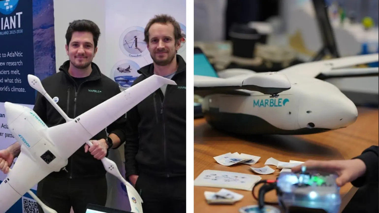
Marble at Qaagitsi: a one day festival held in Nuuk, Greenland designed to bring together researchers and the public.
What have you learned from Greenland Science Week?
Being here has shown me how many other valuable use cases could sit on top of the system we’re building if we deploy it permanently: from whale and narwhal monitoring, to new ideas for stitching drone data into better 3D models, and even ways to use drones to lower instruments into the water for temperature and salinity measurements.
The big positive has been the serendipity of being in the same place as so many people who think differently about similar problems. On the flip side, I’ve also seen how much of the field still runs on short-term, project-by-project funding and a ‘science first, impact later’ mindset. To really tackle something as big as Greenland’s melt, we need sustainable business models and broader use cases alongside pure science, which is exactly the culture ARIA is trying to push toward.
How have you approached engaging with the Greenlandic public and why is it so important to your ARIA work?
Engaging with people in Greenland has been central from the beginning.
There’s a basic responsibility – we need to build relationships and break the pattern of international scientists arriving, measuring, then leaving. Importantly, the people in Greenland are the ones who will feel the impact first. That’s why we’re focusing so much on the iceberg rolling problem in Ilulissat: these events can generate mini-tsunamis that endanger fishers and people onshore. This focus lets us test the whole loop: from collecting data, to building models and designing interfaces that local communities might actually use and trust when they decide whether to go out on the water.
Looking ahead, we want our systems to be permanently deployed in Greenland and eventually beyond, and supported by a mix of scientific and commercial use cases, like resource monitoring. We want to build long term partnerships in Greenland now and inspire the young people who will one day operate, maintain and even redesign these systems for their own needs.
Explore the funded projects in Forecasting Tipping Points